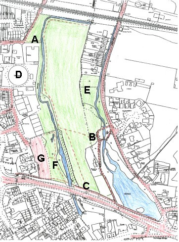
Brook Meadow is found on the eastern side of Emsworth. Grid Ref: SU 751060. From east to west it extends from the industrial units in Palmer’s Road to the gardens of the cottages in Lumley Road. From north to south it extends from the railway line to the A259. Brook Meadow is approximately 400 metres by 250 metres, around 10.5 acres. The nearest car parks are Bridge Road (free) and Palmer’s Road Car Park behind Tesco Express in North Street (pay and display).

The schematic map above shows the three entrances to the meadow. The blue colours represent the mill ponds.
Detailed Map of Brook Meadow
Here is a more detailed map of Brook Meadow and its immediate environment with Brook Meadow site coloured green. Roads and paths are in red and the river, millstream and millpond in blue. The railway runs across the top of the map and the A259 road through Emsworth runs along the bottom. The gasholder (D) has been demolished, but the industrial complex is on the left and Lumley Road on the right.
Access points: A – Seagull Lane… B – Lumley Gate… C – South Gate

